Ansley Lester is an alum of the CHRM program, having received her master's degree in 2024. Her thesis is titled Using Geospatial Information Systems to Predict the Form of 'Roadbeds and Road Segments' Classifications for the Cherokee Trail of Tears in Missouri, 1837-1839. Lester's thesis asks “How can we efficiently use the processes of categorization and Geospatial Information System (GIS) methods and analyses to help identify the ‘form’ that various segments on the Trail of Tears, specifically the listed National Historic Trail (NHT) of the “Cherokee Trail of Tears in Missouri, 1837-1839”? Can a predictive model be developed by looking at the spatial relationships between modern roads and the suspected paths taken by the Cherokee in 1837- 1839? If so, what other information can be gained from this approach?” The classifications are derived from the National Register of Historic Properties (NRHP) Multiple Property Documentation Form (MPDF) and discuss the classifications and criteria that segments of the Trail of Tears must meet to be considered contributing characteristics. The NRHP documentation form defines these different classes of the Trail of Tears into ‘three basic forms:1) Modern Roads, 2) Limited-Use, Passable Roads, and 3) Abandoned Roads. This thesis is limited to the segments of the Trail of Tears that fall within the Mark Twain National Forest (MTNF) boundaries. Though much of the Trail has been modified into modern roads, traces are still evident in many locations along these modern routes that hold integrity from the significant period of the late 1830s. Because the Trail of Tears passes through multiple states and traverses over 6,000 miles, managing the protection of its physical traces can be a logistical challenge for cultural resource managers. Lester developed a carefully constructed GIS model that is able to predict these classifications of various Trail of Tears segments using a sequence of geoprocessing methods, logical operators, and Boolean algebraic expressions. The results identified seventeen segments of the Trail that are likely to hold integrity in the roadbed and road segment form three: abandoned. This is important because this form is the most sensitive to any undertakings and includes the segments that hold the greatest amount of integrity. The results also confirmed that the Trail of Tears does have a spatial relationship with many modern and limited-use roads that are still used today. Basic statistical analysis confirmed that the sample segments used to develop the draft model are representative of the model’s outcomes when applied to a forest-wide scale and that a total of 68.94 miles of the Trail crosses through the Mark Twain National Forest. This thesis also emphasizes collaboration and consultation methods with the Cherokee Nation throughout the chapters as the way forward before this model is considered finished. The intent of this thesis is to provide a management tool for cultural resource managers to predict which segments of the Trail of Tears fall into the three classifications by using a specific set of geoprocessing methods. This tool can be helpful in identifying areas of the Trail that may hold more physical integrity than others and implementing specific protection measures from any undertakings.
Following below is an archived profile.
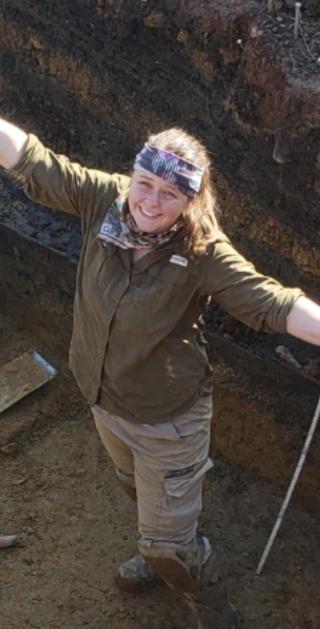
I started out my career in archaeology after I graduated with my BA at Piedmont University in 2019. I began working as an archaeological field technician on various surveys and excavations across the Southeastern United States. After about 2 years, I was accepted into the U.S. Forest Service’s internship program called the Resource Assistant’s Program to work as an archaeologist with the Francis Marion National Forest in South Carolina. I spent a year applying practices pertaining to various cultural resource laws that the federal government is subject to. I then transitioned into a full-time, permanent position for the Forest Service, where I am currently employed. My studies of interest include public archaeology, cultural resource laws, landscape archaeology, and the protohistoric and contact period in North America. I love working in the field and using GIS for cultural resource and heritage management purposes. This has allowed for me to be exposed to multiple subgroups of study within archaeology, which is perfect because I am always learning new things! I am excited to study for my master’s at the University of Maryland to help refine my knowledge of archaeological theory and methods to use throughout the rest of my career.