
Dr. Sean Downey creates high-resolution multi-spectral maps of agricultural land use in the Toledo District, Belize using Unmanned Aerial Systems (UAS)
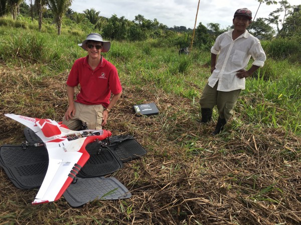
Between January 4-21, 2017, University of Maryland Anthropology professor Dr. Sean Downey and UAS Test Site pilot and engineer Jacob Moschler mapped over 10,000 acres of agricultural forests and community lands in around the Q’eqchi’ Maya village of Crique Sarco in the Toledo District, Belize using a pair of FireFLY6 drones fitted with Micasense Red Edge multispectral cameras. The goal of the project is to understand how short-term subsistence decisions and ecological dynamics can interact community norms to increases long-term environmental sustainability. The UAS are used to collect thousands of georeferneced photographs which are subsequently stitched together into a landscapes-scale images and analyzed using specialized photogrammetry software. This technology will help quantify fine-scale information about Q’eqchi’ land use patterns and the social norms for managing common resources. In addition, the UAS are small and portable, which allows researchers performing aerial surveys to safely engage with and involve community members in the research process. Community members young and old utilized first-person view goggles which allowed them to see for the first time live images of their village and community forests from the perspective of the aircraft. Others assisted with ground operations and in collecting land-use information that will eventually be used to ground-truth the imagery.
The overarching goal of the project is to advance understanding of the dynamics and emergence of "Coupled Human and Natural Systems" through a multi-year study of subsistence-oriented maize agriculture. This research project is a collaboration between the Anthropology Department and the Unmanned Aerial Systems Test Site and it is funded by the University of Maryland and the National Science Foundation: “CAREER: Analyzing the Emergence of a Complex Swidden Management System in the Toledo District, Belize” (NSF# 1553875).

Crique Sarco community members watching live video transmitted from UAS

Sean Downey and Juan Pop collecting ground-truth data at border of Sarstoon-Temash National Park

Jacob Moschler preparing to launch FireFLY6

Moschler explaining Ground control station

Sample of photogrammetry results
Published on Fri, 01/27/2017 - 12:50